Church Buttes
The 1915 Lincoln Highway Guidebook doesn’t list Church Buttes; the first time Church Buttes is mentioned is the 1918 guide book; it states that this is 425 miles from the Nebraska-Wyoming border. In addition to the Palisades near Green River, these natural buttes stand alone on the eastern edge of the Unita County line. Seeing these buttes for the first time is an affirmation as to why American painter Thomas Moran loved working in Wyoming.
The view below is from the north side of Church Buttes. The new image, (color) is from the south side.
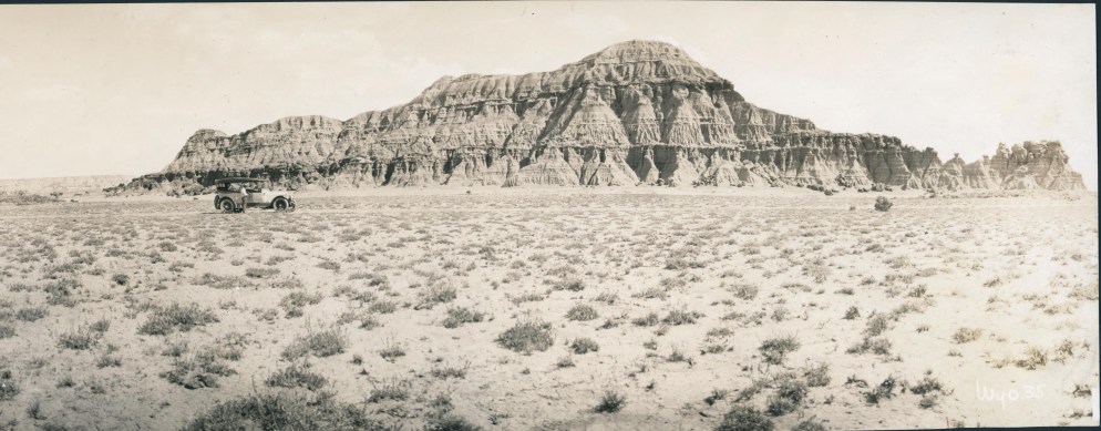
“CHURCH BUTTES… eroded blue and black sandstone cliffs, in a mass resembling a cathedral, rise 75 feet above the surrounding hills. Similar buttes thrust up near by[sic]. Flats west of Church Buttes are marked with patches of greenish shale and clumps of grease -wood.” (2)

Lyman
1915 LHA: New York: 2343 miles, San Francisco: 1041 miles Population 800. Uinta County. Two hotels, accommodations for 50. Marshall, $1.00; Lyman, 50c. Route marked through town and county. Three general business places, telephone, Gas, 30c. Oil. One newspaper, 2 public schools, 5 automobiles owned. Camp site. Mormon settlement.
LYMAN TO EVANSTON
The roads vary from good gravel to good dirt, well graded. (End LHA)(3)
“Named for Francis M.W. Lyman, an apostle of the Mormon Church in 1898; originally called Owen for Owen Woodruff, who with Lyman started the town. An agricultural experiment station is here.”(4)
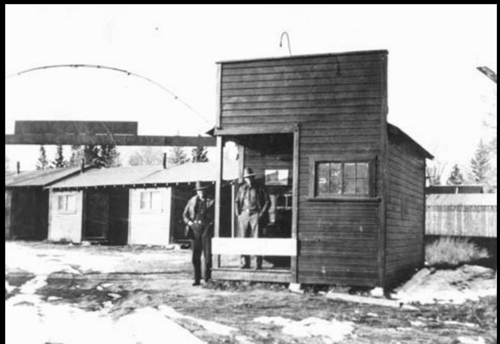
Ft. Bridger
1915 LHA: New York: 2349 miles, San Francisco: 1035 miles Population 100. Altitude 7,000 feet. Uinta County. One hotel, accommodations for 15. Rocheford; lodging 50; meals, 35. One garage; storage, night 50c. Gas, 30c. Route marked through town and county; signs at town limits. Telephone, 1 public school, 5 automobiles owned, 1 general business place. The road turns square here. On the left is a large house at which meals may be obtained. By walking straight ahead through the lane and trees you will pass on the right, old officers’ quarters, and immediately beyond enter the old parade grounds. On the opposite side of the parade grounds are the old buildings of Fort Bridger, now in ruins, and on the left are the old guard houses and prison. Fort Bridger is where Gen. Johnson quartered his army in 1857 when operating against the Mormons. Camp site. (End LHA)(3)
“Jim Bridger, realizing that the need for a stopping place, established this log trading post and blacksmith shop in 1843. It was then in Mexican territory. Bridger was one of America’s greatest frontiersmen and scouts; he said he came when Laramie Peak was a hole in the ground.
Fort Bridger was taken and improved by the Mormons in 1853 (Jim Bridger claims he never sold it), then burned by them when they were fleeing from Johnson’s United States Army in 1857; later that year it was reconstructed by the United States Army and remained a military post until 1878. It was a Pony Express station in 1860.
Fort Bridger has several Wyoming firsts: the first piano was freighted here by ox team from the Missouri River in 1864; the first schoolhouse in Wyoming was built by Judge W. A. Carter in 1866 – it is still standing; the first printing press and newspaper was at the fort 1863. Martha Jane “Calamity Jane” Canary washed dishes here as a girl, before she commenced her famous bull-whacking career. A treaty with the Shoshones was made here in 1869.”(5)

Piedmont
“Originally called Byrne for Moses Byrne, [a] pioneer. Because of the likeness to Bryan, the name was changed to Piedmont meaning “at the foot of the mountains.” Mrs. Byrne suggested the name Piedmont in memory of the Italian region where she once lived. Moses Byrne built five large charcoal kilns to produce charcoal for Utah smelters. Their ruins still stand. The Union Pacific Railroad once had a roundhouse here.”(8)
About six miles south of the original (1913) alignment of the Lincoln Highway is the ghost town of Piedmont. A man named Moses Byrne built at least five kilns with the intention of producing charcoal, for use in ore smelters in Salt Lake City, Utah. According to one of the placards at the site, each kiln was loaded with approximately 30 cords of pine trees. These would then be fired – not burning – but smoldering. This would proceed for six to eight days, the wood would then be cooled for another five days. After which it would be loaded onto rail cars for transport. The process would produce about 25 bushels of charcoal for every 100 bushels of timber. Charcoal was favored over wood in the smelters because the temperatures required would routinely exceed 2000 degrees Fahrenheit. It is reported that at the height of production in 1873, the kilns were yielding over 100,000 bushels of charcoal every month. The kilns ceased production sometime by the turn of the century as an alternative, coke, was found to be just as suitable for smelting and blacksmith needs. The placards indicate that Union Pacific rerouted the rail line to the north sometime in the early 1900’s, and thus left Moses Byrne no economical means of getting his product to market.
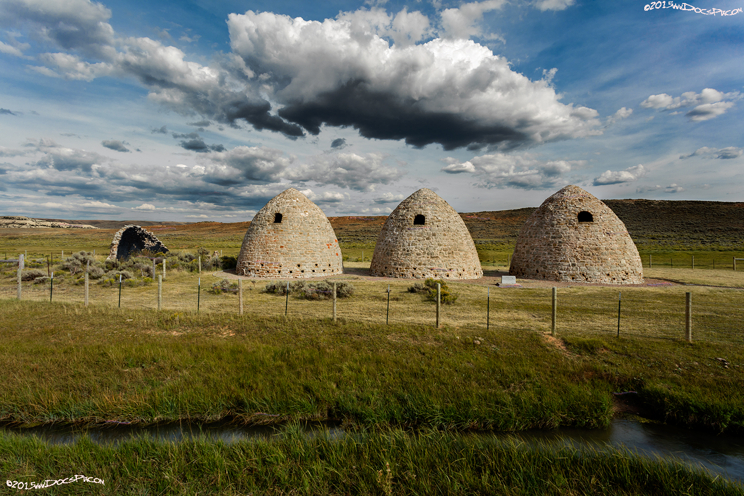
The Wyoming State Parks website states that there were originally 40 kilns, but the nomination form for the National Registration of Historic Places indicates only five kilns. As does the site today – the three that are complete and the ruins of a fourth; along with a fifth that was probably a kiln site are what remain. (9)(10)
Citations
1: http://quod.lib.umich.edu/l/linchigh/x-lhc1057/lhc1057. University of Michigan Library Digital Collections. Accessed: October 25, 2015.
2: Book: Federal Writers Project (1941), Wyoming: A Guide to Its History, Highways, and People, American Guide series, North American Book Dist LLC, p. 261.
3: “The Complete Official Road Guide of the Lincoln Highway”, (published by The Lincoln Highway Association, National Headquarters, Detroit, Michigan – copyrighted 1915), Box 98, Folder Number 1, Payson W. Spaulding papers, 1886-1980, Collection Number 01803, American Heritage Center, University of Wyoming.
4: Book: Wyoming Place Names, Pg. 127, 2004 Ed. Mae Urbanek, Mountain Press Publishing Company, Missoula, MT.
5: Book: Wyoming Place Names, Pgs. 68-69, 2004 Ed. Mae Urbanek, Mountain Press Publishing Company, Missoula, MT.
6: Website: http://www.wwcc.wy.edu/wyo_hist/lincolnhighway4.htm Accessed 10Oct2015
7: Website: http://www.wyomingtalesandtrails.com/bridger40s.html Accessed 10Oct2015
8: Book: Wyoming Place Names, Pg. 155, 2004 Ed. Mae Urbanek, Mountain Press Publishing Company, Missoula, MT.
9: Web Site: https://en.wikipedia.org/wiki/Piedmont_Charcoal_Kilns_State_Historic_Site (Reference #2: Barnhart, Bill (1971). “National Register of Historic Places Inventory – Nomination Form: Piedmont Charcoal Kilns” (PDF). National Park Service) Accessed 10Oct2015
10: http://wyoparks.state.wy.us/Site/SiteInfo.aspx?siteID=29 Accessed 10Oct2015
