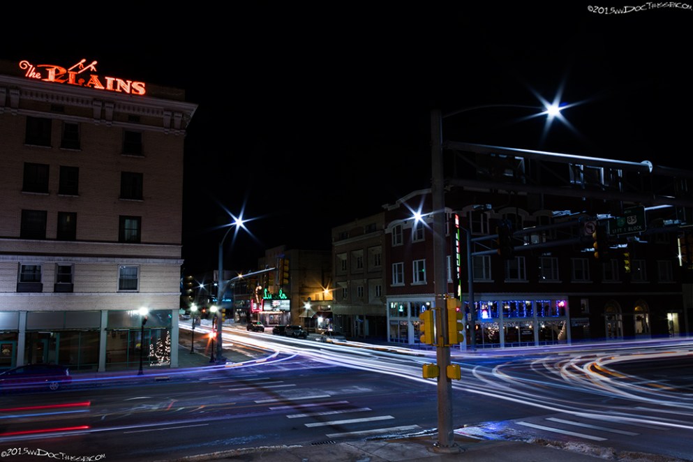
Cheyenne
1915 LHA: New York: 1989 miles. San Francisco: 1395 miles. Population 13,000. Altitude 6,054 feet. County Seat, Laramie County. Capital of Wyoming. Nine hotels; Plains, $1.00 and up, Eu.; Inter Ocean, $1.00 and up, Amer. and Eu.; Albany, $1.00 and up, Eu.; Normandie, $1.00 and up, Eu.; Metropolitan, $1.00 and up, Amer. and Eu. Five garages; storage, night 50c; washing, $1.00; Gas, 20c; Oil, 75c. Local speed limit 10, 15 and 20 m. p. h. enforced. Route marked through city and county; signs at city limits. Extensive road improvement planned for 1915. Good detour road without mileage increase over Lincoln Highway. Four banks, 3 r.r’s, 200 general business places, 4 Exp. Cos., 2 Tel. Cos., 2 newspapers, 7 public schools, electric lights, trolley, water works, 350 automobiles owned, Automotive Club, Commercial Club, 367 members. Good camp site, good fishing, beautiful mountain scenery. Detour here for Cherokee Park, Colorado, following the route marked with a blue band.
Lincoln Highway Local Consuls, E.S. Johnston, Charles D. Carey, H. P. Hynds.
The first one of the five State Capitals to rename street traversed by the Lincoln Highway, “Lincoln Highway,” by official resolution.
Near Cheyenne is located Fort D. A. Russell, a military post, consisting of one regiment of infantry, two batteries of field artillery, one squadron of cavalry and a full hospital corps – about 2,200 men – with a large riding school, a target range, and a tract twenty miles from the city. A $400,000 federal building, Carnegie library, 4 public parks, beautiful lake drives on natural granite roads.
Blue Book, Vol. 5 – Route 906 to Denver. Routes 916, etc., to Douglas, Casper, Shoshone and one possible route to Yellowstone Park. (end LHA)(1)
Cheyenne today is home to technology companies, and important government operations including a super-computer for the National Center for Atmospheric Research, (NCAR). Cheyenne Frontier Days hosts the biggest and oldest rodeo in the country, with an average of a quarter million fans attending annually.

Laramie
1915 LHA: New York: 2041 miles. San Francisco: 1343 miles.
Population 8,500. Altitude 7,153 feet. County seat, Albany County. Five hotels, accommodations for 600. Connor Hotel, $1.50 and up, Eu. ; Union Pacific, $1.50 and up, Eu.; Kuster Hotel, $1.00 and up, Eu.; Johnson Hotel, $1.00 and up, Eu.; Phillips Hotel. Three garages, storage, night, 50c; washing $1.00and up; Gas 23c; Oil, 75c. Local speed limit 12 m. p. h., enforced. Route marked through city and county; signs at city limits. Extensive road improvement planned for 1915. Good detour road with mileage increase over Lincoln Highway. Three banks, 2 R.R’s, 300 general business places, 1 Exp. Co., 2 Tel. Cos., 2 newspapers, 4 public schools, 250 automobiles owned, Commercial Club, 100 members. Good hunting and trout fishing, good camp site.
Lincoln Highway Local Consuls, C.D. Spaulding, Elmer Lovejoy, H.G.Knight.
Among the industries of Laramie are the railroad shops for the Laramie-Rawlins section of the Wyoming division, employing from 150 to 200 skilled mechanics; the rolling mills, which employ several hundred men; cement and brick plants; stock yards; an electric light plant, planning mill and two lumber yards; stone quarry; huge reservoirs where immense crops of ice are harvested. The University of Wyoming – including the State Agricultural College, the School of Mines, the United States Experiment Station, the Wyoming State Normal School, the Wyoming State School of Music and the University Preparatory School – is located here. A federal building costing $100,000 and a library costing $20,000 have recently been completed. Fort Sanders, a noted post in the wilderness (about four miles from Laramie), was the first garrison post established in Wyoming.
Note.-Here an alternate route to Rawlins is offered, via Elk Mountain. This route offers many attractions to the tourist, sportsman and photographer. The distance to Rawlins being about 18 miles shorter than via Medicine Bow. Route well marked.
From LARAMIE to MEDICINE BOW the roads are generally level, some dirt, some dirt and gravel, some have been graded, showing the possibility of improved roads by the skillful treatment of the native material. (End LHA)(1)

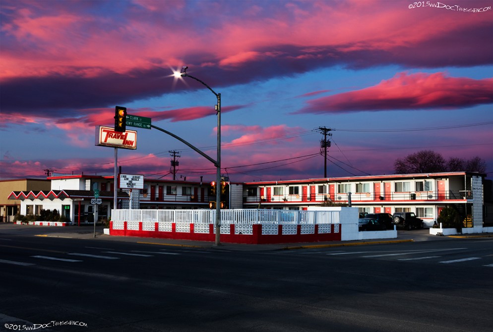


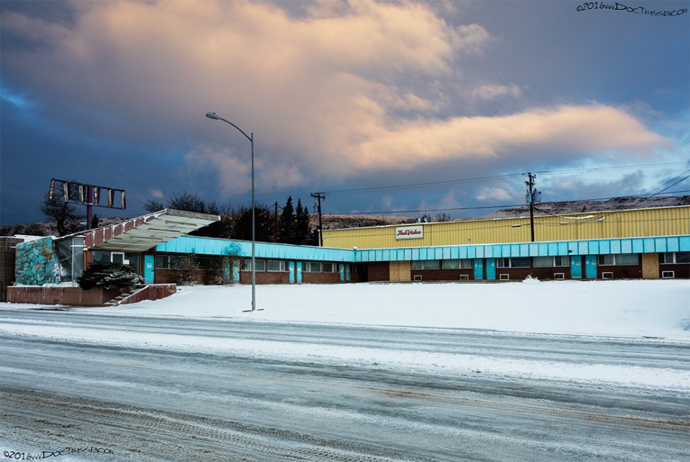
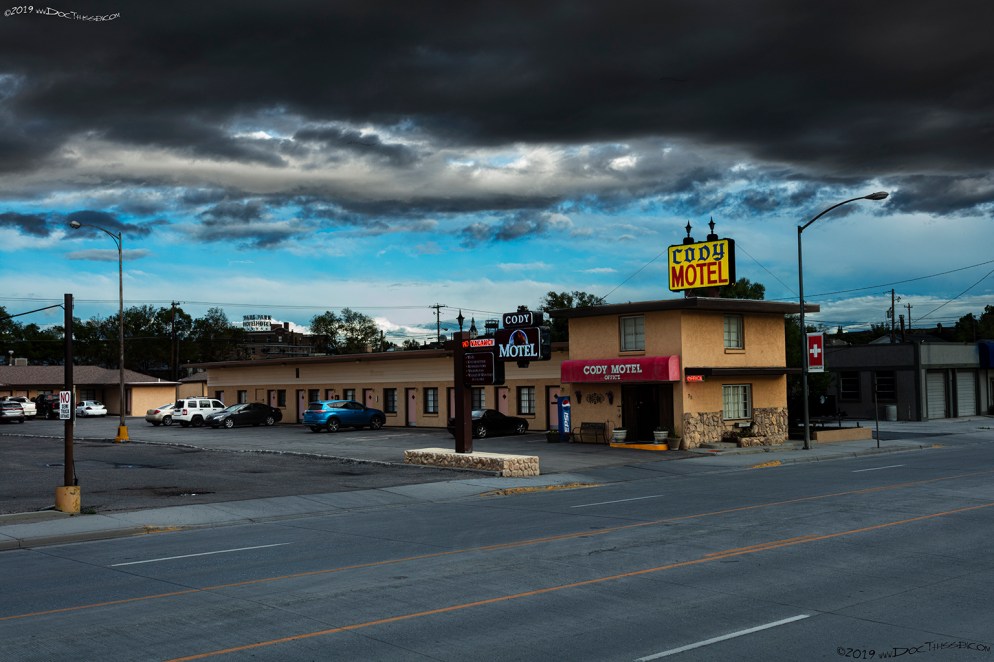
The Thunderbird Lodge advertised that it has a heated pool, color TV & phones. These amenities were considered necessary to lure travelers into the roadside motels of the day.
Rawlins
1915 LHA: New York: 2160 miles. San Francisco: 1224 miles.
Population 4,200. Altitude 6,748 feet. County seat, Carbon County. Three hotels: Ferris, 75c-$2.50 up, Amer.; Abbott, $1.50 up, Amer.; Cottage, $1.00 up, Amer. Two garages: storage, night, 50c; washing, $1.50. Gas, 25c; Oil, 75c. Local speed limit, 12 m. p. h., not enforced. Route marked through town and county. Three banks, 2 R.R’s, 30 general business places, 1 Exp. Co., 2 Tel. Cos., 2 newspapers, 3 public schools, electric lights, water works, 150 automobiles owned. Camp site.
Note.-Here an alternate route to Laramie is afforded via Elk Mountain. This route offers many attractions to the tourist, sportsman and photographer. The distance to Laramie being about 18 miles shorter than via Medicine Bow. Route well marked.
Between this point and Yellowstone Park there is a road passing through Lander, thence to the southern boundary of Yellowstone Park. It is reported by those having first-hand information that this route to Yellowstone Park is less desirable than the one entering Yellowstone Park from the West via Granger, Wyoming, Pocatello, Idaho, thence directly to the western entrance to Yellowstone Park, where there are accommodations for tourists, etc.


From RAWLINS to POINT OF ROCKS the tourist encounters some roads which in fair weather are really excellent, but cause trouble in wet weather. (End LHA)(1)
Rock Springs
1915 LHA: New York: 2263 miles. San Francisco: 1121 miles.
Population 7,500. Altitude 6,264 feet. Sweetwater County. Three hotels: Commercial Hotel, $2.50, Amer. and Eu. ; Elk Hotel, 75c – $2.00, Amer.; Moore Hotel, $1.50 up Eu. Two garages. Gas 23c, oil, tires. Local speed limit, 8 m. p. h., enforced. Route marked through town and county; signs at town limits. Extensive road improvement planned for 1915. Good detour road without mileage increase over Lincoln Highway. One R.R. crossing at grade, protects. Three banks, 1 R.R. 7 general business places, 1 Exp. Co., 1 Tel. Co., 1 newspaper, 8 public schools, electric lights, water works, 104 automobiles owned. Automobile Club. Camp site.
Large coal mining industry is found at Rock Springs. The mines employ about 3,000 men, and produce many million tons of coal annually. Rock Springs was named after a saline spring of water which boils up near the foot of the bluff. An artesian well was sunk at this point, 1,145 feet deep. The Wyoming Hospital and other state buildings are located here. From this point to Green River the scenery is grand and impressive.
Between this point and Yellowstone park there is a road passing through Lander, thence to the southern boundary of Yellowstone Park. It is reported by those having first-hand information that this route to Yellowstone Park is less desirable than the one entering Yellowstone Park from the West via Granger, Wyoming, Pocatello, Idaho, thence directly to the western entrance to Yellowstone Park where there are accommodations for tourists, etc.
Note.-Pinedale, 100 miles north, is said to rival Yellowstone Park in natural scenery. Streams are bridged. Fremont Lake, 17 miles long, affords excellent fishing and camping.
Between here and Yellowstone is a route often taken, Inquire for directions at Rock Springs.
ROCK SPRINGS TO GREEN RIVER
Here the tourist will find roads which have been well graded and graveled.
(End LHA)(1)

Green River
1915 LHA: New York: 2279 miles. San Francisco: 1150 miles.
Population 1,800. Altitude 6,083 feet. County seat, Sweetwater County. Four hotels, accommodations for 200. Green River Hotel, $1.00 Eu.; Union Pacific Hotel, $1.00, Eu.; Big Horn Hotel, 50c – 75c, Eu.; Home Hotel, 50c – $1.00, Eu. Two garages: storage, night, 50c; washing, 50c up. Gas 28c; Oil, 60c. Local speed limit, 12 m. p. h., enforced. Route marked through town and county; signs at town limits. One R.R. crossing at grade, protected. Two banks, 2 R.R’s, 15 general business places, 1 Exp. Co., 2 Tel. Cos., 1 newspaper, 1 public school, electric lights, water works, 15 automobiles owned. Commercial Club, 50 members. Camp site. Good hunting and fishing.
This point is situated on Green River, which about 150 miles south unites with the Grand and becomes the Colorado River. About three miles west of Green River is the famous Fish Cut. Here, in 1890, Professor O.C> Marsh, of Yale College, found petrified in abundance, and a small bed fossil insects. (End LHA)(1)

Evanston
1915 LHA: New York: 2384 miles. San Francisco: 1000 miles.
Population 3,000. Altitude 6,300 feet. County seat, Uinta County. Three hotels, accommodations for 150: Evanston, $1.00, Eu.; Smith, $1.00, Eu.; Marx, 50c. Two garages: storage, night, 50c. washing, 50c and up. Route marked through town and county; signs at town limits. One R.R. crossing at grade, protected. Three banks, 1 R.R., 1 Exp. Co., 2 Tel. Cos., 2 newspapers, 4 public schools, electric lights, water works, 40 automobiles owned. Commercial Club, 100 members. Camp site.
Lincoln Highway State Consul, Payson W. Spaulding.
Five miles west of here is the Wyoming-Utah State line.
Evanston is situated in Bear River Valley. Has a new $12,000 high school; flour mill; ice storage plant, 18,000 tons capacity; a city park, machine shops, a new $200,000 federal building. The city is the seat of the State Insane Asylum, and the United States Land Office. It is also headquarters for oil men. Coal fields cover a large extent of territory. (End LHA)(1)


Citations:
1: “The Complete Official Road Guide of the Lincoln Highway”, (published by The Lincoln Highway Association, National Headquarters, Detroit, Michigan – copyrighted 1915) , Box 15, Folder Number 1, Payson W. Spaulding papers, 1886-1980, Collection Number 01803, American Heritage Center, University of Wyoming.
